
Pictures From Naches Peak Trail Near Mt. Rainier
Having been on one of the most beautiful hikes during our trip to Seattle, it would be a grave disservice not to post a few pictures of the hike here. For all you Microsofties out there (and other geeks in Washington state), I highly recommend getting out of the office for this hike. Bring some water and sunscreen.
The four to five mile trail begins on the Pacific Crest Trail No. 2000 (the entire Pacific Crest Trail stretches from Canada to Mexico) from Chinook pass. At the parking area, you’ll cross Route 410 by walking on a wooden overpass seen above. The two in the picture below are the friends we visited, Dan and Grace Kalish.
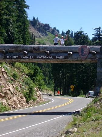
Car careens off the road while hikers wave at camera.
After a bit of hiking, through lush green forest, we came upon the first of several lakelets. The hike has an elevation gain of just 700 feet, so it’s fairly easy, though we managed to make it a challenge by taking a wrong turn and visiting a full fledged lake. The detour set us back around another half hour.
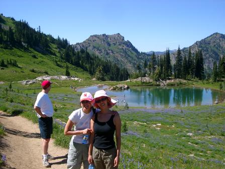
Dan wonders how those people in the lake got so small
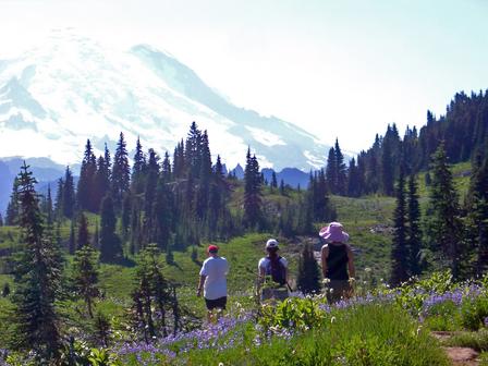
Akumi and I had a plane to catch that evening and we were running out of time and getting a bit worried. It took us a bit longer than we expected to get out here, and the unexpected detour cost us even more time. At that point, we decided to play it safe and return back the way we came and not complete the loop. What a terrible decision that would have been. When we returned to the main loop, another hiker told us we were exactly halfway around the loop. That led to the obvious conclusion that we should continue. What a fortuitous decision, as this trail saves all the best views for those willing to stay for act 2.
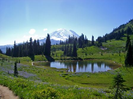
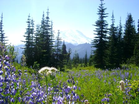
You’ve seen one picture perfect lake surrounded by violet wildflowers
in the woods with an enormous mountain backdrop, you’ve seen them all.
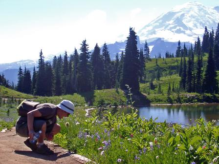
Man loves nature. Man eats nature.
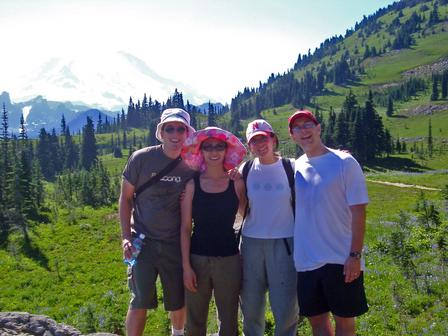
Not one to let a photographic opportunity go by, we made sure to pose for a group shot with our new friend, Mt. Rainier. As big as it looks in the photos, it looked absolutely ginormous in person. It positively encroaches on us as we take this shot.
That cardboard backdrop is so damn convincing!
For most of the rest of the hike, we were treated to wonderful views of the mountain. It started to get rather blase. “Yet another view of the one of the most spectacular woodland scenes I’ve ever seen. Ho hum.”
Tired of my incessant demands to stop and pose, my friends pose a
mutiny.
Rainier tries to hide behind some trees.
At the end, the hike ended up being reasonably vigorous due to our detour, but quite manageable over all. The next time we hike here, we plan on making it a picnic next to the lake with the view of the mountain. I highly recommend this hike.
Directions From Seattle: via the Seattle Post Intelligencer
Go south on Interstate 5 and take the state Route 18/Auburn exit (before Tacoma). Follow the signs to Auburn and state Route 164 (take the second Auburn exit off Highway 18, not the C Street exit). Follow 164 through Enumclaw to state Route 410 and turn left. Continue east to Chinook Pass, about 44 miles from Enumclaw. At Chinook Pass, continue a short distance past the wooden overpass to a parking area on the left side of Route 410 (the Mather Memorial Parkway). This is the parking area for the PCT with stock access and portable toilets, elevation 5,040 feet. If you are beginning from Tipsoo Lake, park at the Tipsoo Lake picnic area lot and look for the signed Naches Peak Loop trailhead opposite the lake.
Comments
0 responses